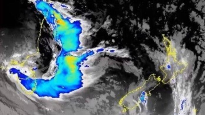
A “decent” sized front is making its way from Australia’s southeast coast to New Zealand.
The fast-moving system was expected to hit on Friday and move up the country on Saturday.
The front looked quite large on the satellite image, but MetService weather forecaster Paul Ngamanu said it was expected to weaken as it moved across the country.
Heavy rain was expected to batter the South Island’s west coast on Friday, but Ngamanu said it was hard to put a number on how much rain would fall. This system was similar to the extra-tropical low that formed in the Pacific and moved across the South Island last week, but wouldn’t bring as much humidity.
“We are expecting heavy falls for the likes of Westland and Fiordland on Friday … Northerly gales [were also] affecting Fiordland on Friday.”
As the system moved north, showers were expected to fall across the North Island. Unfortunately the rainfall wouldn’t be enough to provide relief from consistent drought conditions in Northland, Auckland and northern Waikato.
In addition to the wet weather, Ngamanu said temperatures nation-wide would also be warming up.
“It will be a little warmer ahead of the front but it’s followed by a cooler flow.”
Temperatures weren’t expected to be record-breaking, instead they would just be above average. Hastings had a maximum of 31 degrees Celsius on Friday and Saturday, and Napier was forecast to reach 30C on Friday and 31C on Saturday.
It wouldn’t be as warm in the main city centres – temperatures in Christchurch were expected to peak at 29C on Friday and 25C on Saturday, Wellington would reach 22C on both days, and Auckland 28C and 26C.
Minimum temperatures across the country were still quite high, Ngamanu said, so it would still be “quite muggy”. The humid conditions that had been impacting most of the country were created by the remnants of ex-Tropical Cyclone Uesi and the associated extra-tropical low that moved across the country last week.
However, conditions would ease come Sunday as a less humid air mass was blowing in and temperatures were expected to go “back to normal”.
Source - stuff


