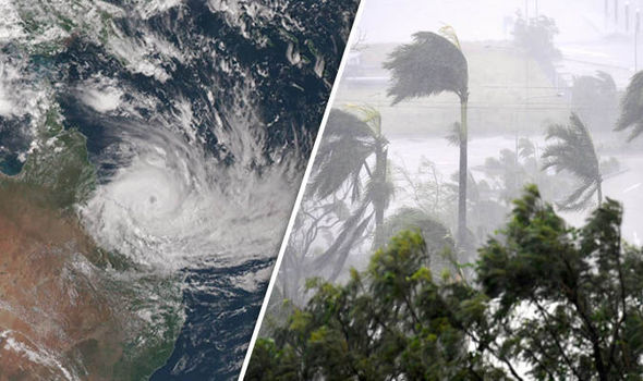
Wellington flights are being cancelled and ferry services restricted, while heavy downpours have soaked parts of the South Island overnight.
High winds forced the early cancellation of several Air New Zealand domestic flights on Tuesday morning, with Wellington travellers asked to consider deferring non-urgent travel.
At 7.20am, 16 flights arriving into the capital and a further 17 departing had been abandoned, with the airline offering fare flexibility for affected travellers. Air New Zealand said disruption in and out of the capital was expected till mid-afternoon.
Due to strong winds some flights may be disrupted throughout the day. Check our live flight information for details: https://t.co/I1SNkbWdka pic.twitter.com/T2NCE6j4aS
— Wellington Airport (@WLGAirport) December 2, 2019
Customers who were able to make flight changes online would be notified. Those unable to make changes online should contact Air New Zealand via private message on Facebook or Twitter, or by contacting the airline’s contact centre.
Extra services had been put on for Tuesday evening to accommodate disrupted customers, but customers were asked to defer non-urgent travel.
“Air New Zealand is offering fare flexibility for the next 72 hours, where customers with cancelled flights will have the option to transfer their booking to another date or hold the fare value in credit for up to 12 months toward future travel.”

The storm has also forced Metlink to restrict some morning ferry sailings. As well as Wellington, Nelson and the Canterbury high country also have warnings are in place for strong winds with gusts as high as 140kmh.
Metservice meteorologist Tahlia Crabtree said the peak of the winds were still yet to come for Wellington. Wind gusts had so far reached 83kmh at Wellington Airport and 120kmh at the top of Mt Kaukau.
But a front moving up the South Island would bring some rain and stronger winds, gusting up to 140kmh in exposed places.
MetService was warning of potential damage to trees and powerlines.
Due to current conditions, there are no sailings in or out of Seatoun this morning. Suggest Scots catch 7.45am from DB – QW. Apologies,…
— Metlink Wellington (@metlinkwgtn) December 2, 2019
The same front was forecast to cause extreme weather events all around the country – but different regions would be affected in different ways.
Overnight Monday, some of the heaviest rain was in the far southwest of the country, with MetService recording 180mm of rain falling in Milford Sound between about 6pm Monday and 6am Tuesday.
“That’s a lot of rain even for them,” MetService severe weather forecaster William Nepe said. Peak rainfall intensities were 25-30mm an hour.
Tuesday's emojicast:
?
?
??
????
???☁️
???
??
???
??
??? ☁️
??
???
??☁️
?— NIWA Weather (@NiwaWeather) December 2, 2019
Heavy rain also fell in parts of Westland, with one station at an elevation of about 1500m recording more than 350mm from midday Monday to 6am Tuesday. Some other stations in the Westland ranges received around 180mm.
Amounts closer to the coast included 75mm since midday at Haast, and 50mm at Hokitika and Greymouth. Arthur’s Pass had about 180mm since midday and Mt Cook Village about 120mm.
“It’s going to keep raining today,” Nepe said, although it was expected to ease in the west of the South Island on Tuesday. On Wednesday rain rates could pick up from Hokitika to northern Fiordland.
“This is expected to be a sustained period of rain this week, waxing and waning as various features come through,” Nepe said. The air moving across the country was expected to keep coming from the northwest all the way through to Sunday or Monday. Parts of the western South Island “could be looking at a lot of rain over a long period.”
A front moving across the country on Tuesday would bring some rain to the North Island. “But it’s moving through, so a brief period of rain.” There could be a few millimetres in the east of the South Island on Tuesday.
Source: Stuff
Featured Image: Strom is going to hit Newzealand. (Photo / Via google image/ express.co.uk)


